- Attractions
- Activities
- Lodging + Campgrounds
- Area Info
- Services
- Transportation

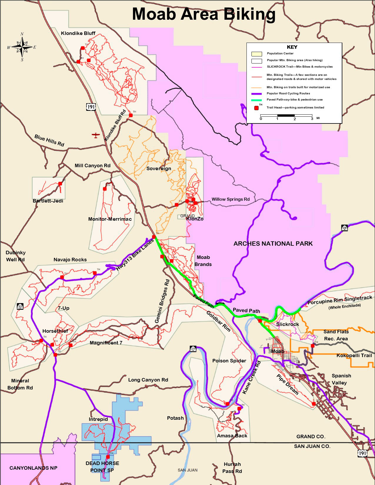
Moab Mountain Biking
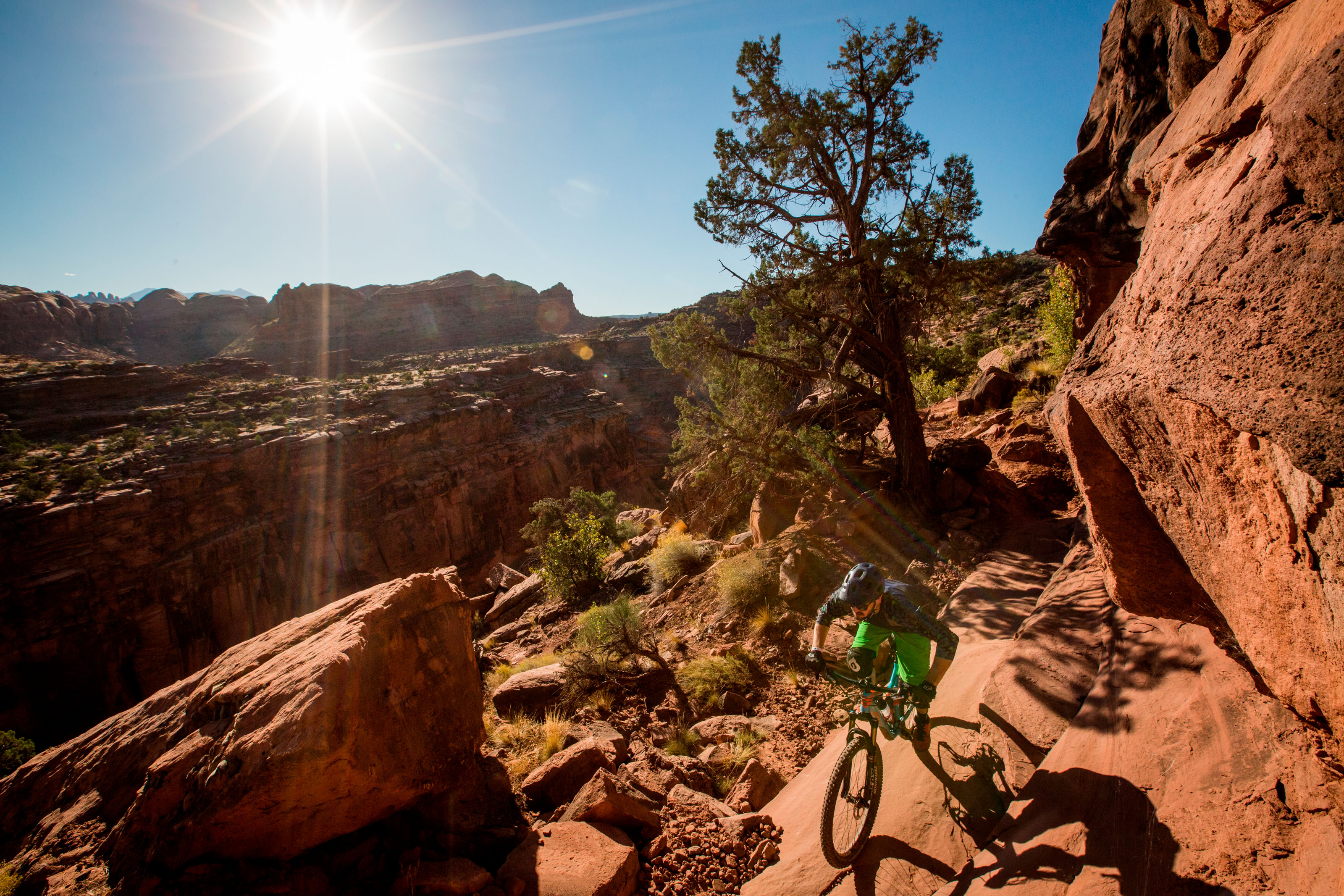
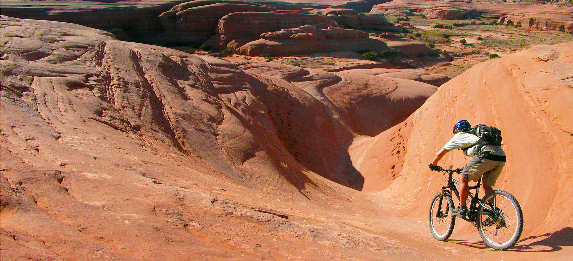
Moab is home to the greatest mountain biking on the planet!
Moab Brands Trail System Recommended Routes
Klonzo Trail System Recommended Routes

Easy

Intermediate

Difficult

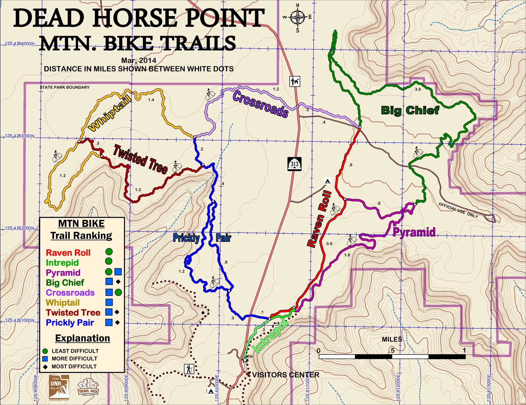
Big Chief
Crossroads
Great Pyramid
Intrepid
Prickly Pear
Raven Roll
Twisted Tree
Whiptail
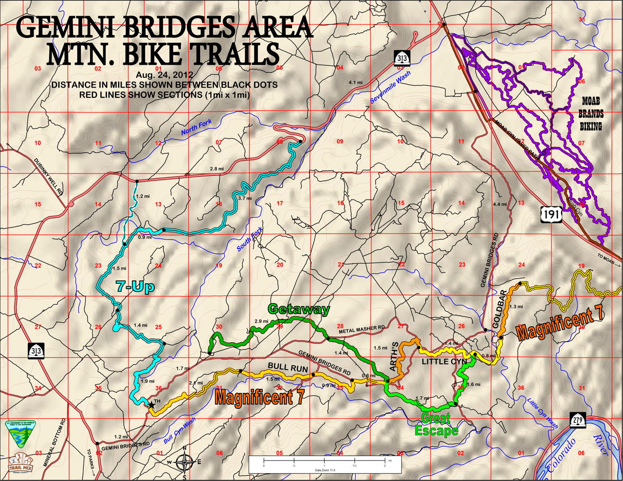
7-Up
Arth’s Corner
Bull Run
Getaway
Gemini Bridges Road (4×4)
Gold Bar 4×4
Golden Spike 4×4
Great Escape
Little Canyon
Poison Spider 4×4
Portal
Hurrah Pass Trail
Agate East
Agate West
Alaska
Azurite
Baby Steps Loop
Chilkoot Pass
Dino-Flow
EKG
Homer
Inside Passage
Instep
Jasper East
Jasper West
Jurassic
Klondike Bluff
Little Salty
Malachite
Mega Steps
Miner’s Loop
Nome
Sidestep North
Sidestep South
UFO
Boondocks
Borderline
Carousel
Dunestone
Cross Canyon
Gravitron
Gypsy
Houdini
Hotdog
Magician
Midway
Red Hot
Roller Coaster
Secret Passage
Snippet
The Edge
Topspin
VertiGo
Wizard
Wahoo
Zephyr
Zoltar
Burlfriends Trail
Burro Pass Trail
Carpenter Basin Trail
Clark Lake Loop Trail
Clark Lake Trail
Hazard County Trail
Hell Canyon Trail
Jimmy Keen Trail
La Sal Pass
Medicine Lake Trail
Moonlight Meadows Trail
Schuman/Shafer Creek Trail
Squaw Springs Trail
Upper Porcupine/Slickrock (UPS) Trail
Warner Lake
Warner To Oowah Trail
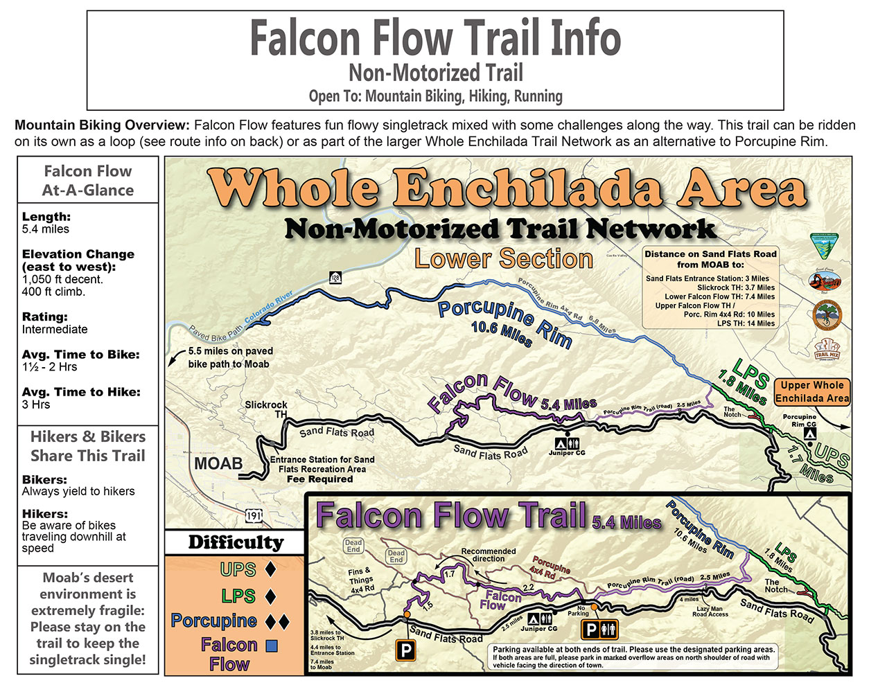
Whole Enchilada Trail
Bar-B
Bar-M Loop
Chuckwagon
Circle-O
Deadman’s Ridge
Escape
EZ
EZ Spur
Killer-B
Lazy
Long Branch
Maverick
North 40
Pipeline Spur
Rockin’ A
Rusty Spur
Sidewinder
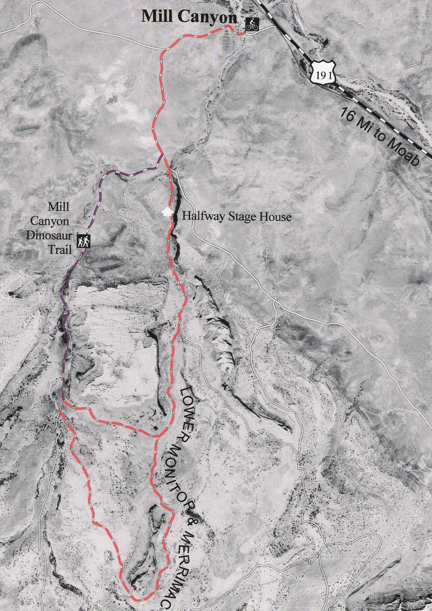
Lower Monitor & Merimac Trail
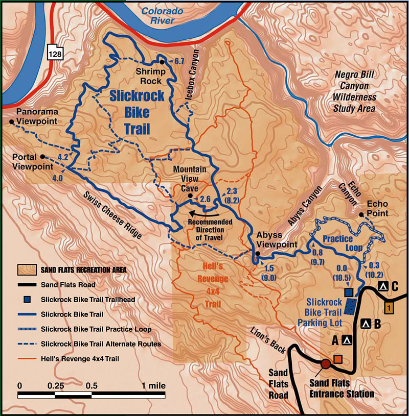
Slickrock Bike Trail
Porcupine Rim Trail
LPS (Lower Porcupine Single Track)
Falcon Flow
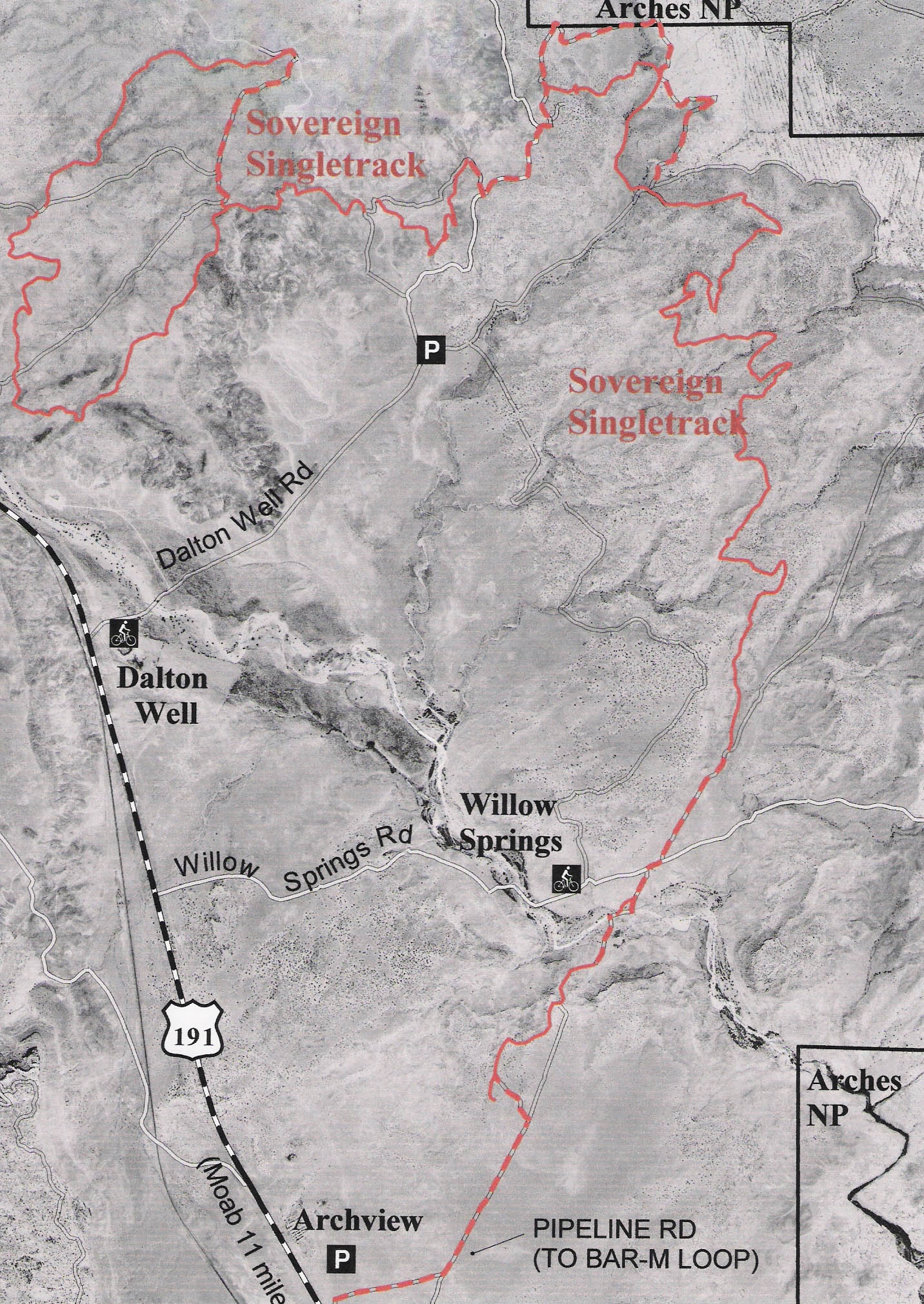
Sovereign Single Track
Burro Pass
Hazard County
Kokopelli Leg
UPS (Upper Porcupine Singletrack)
LPS (Lower Porcupine Singletrack)
Porcupine Rim
Easy
Intermediate
Difficult
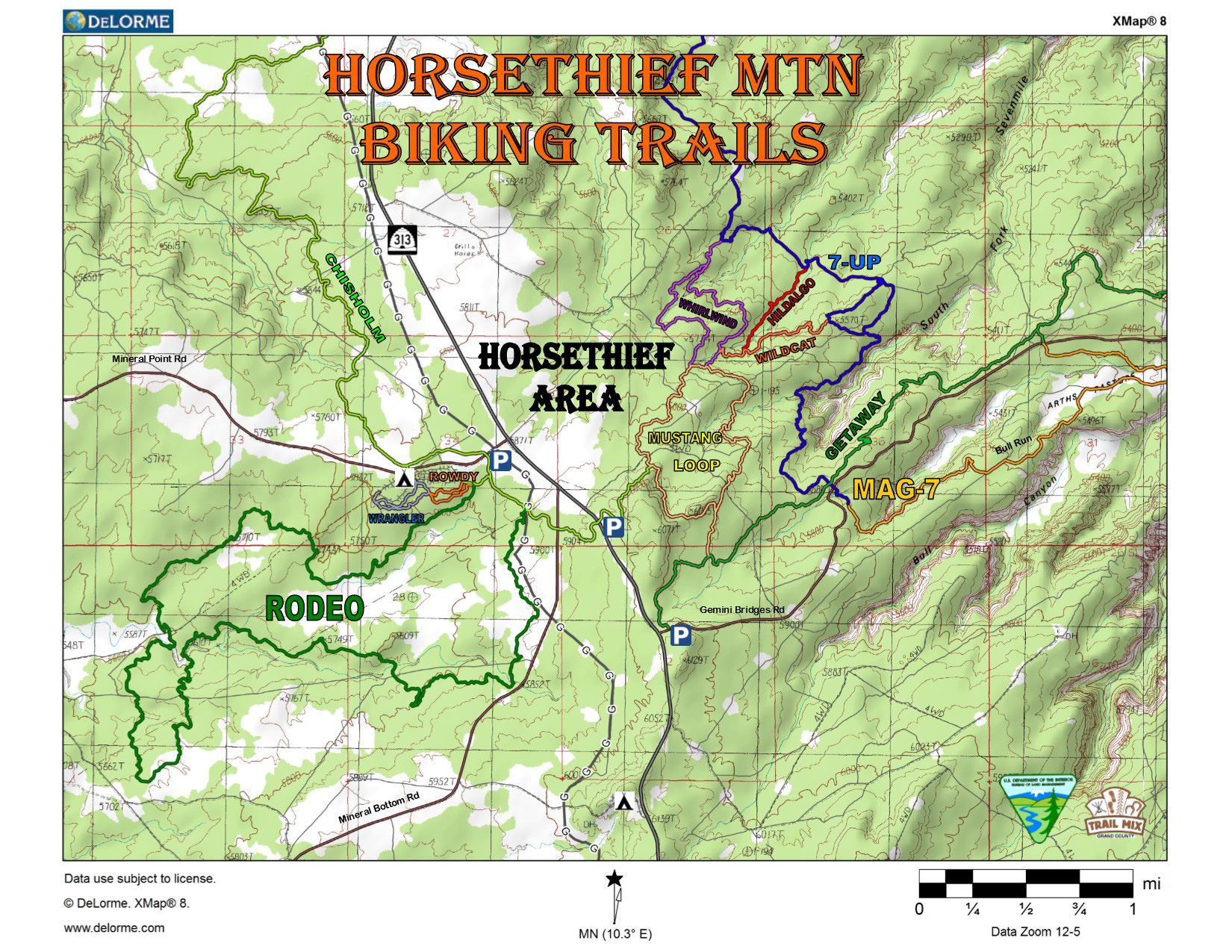
The Magnificent 7-This system of trails/roads currently has 2 options: Using the Portal Trail to end at SR-279 or Using the Poison Spider 4×4 road as the exit to SR-279.
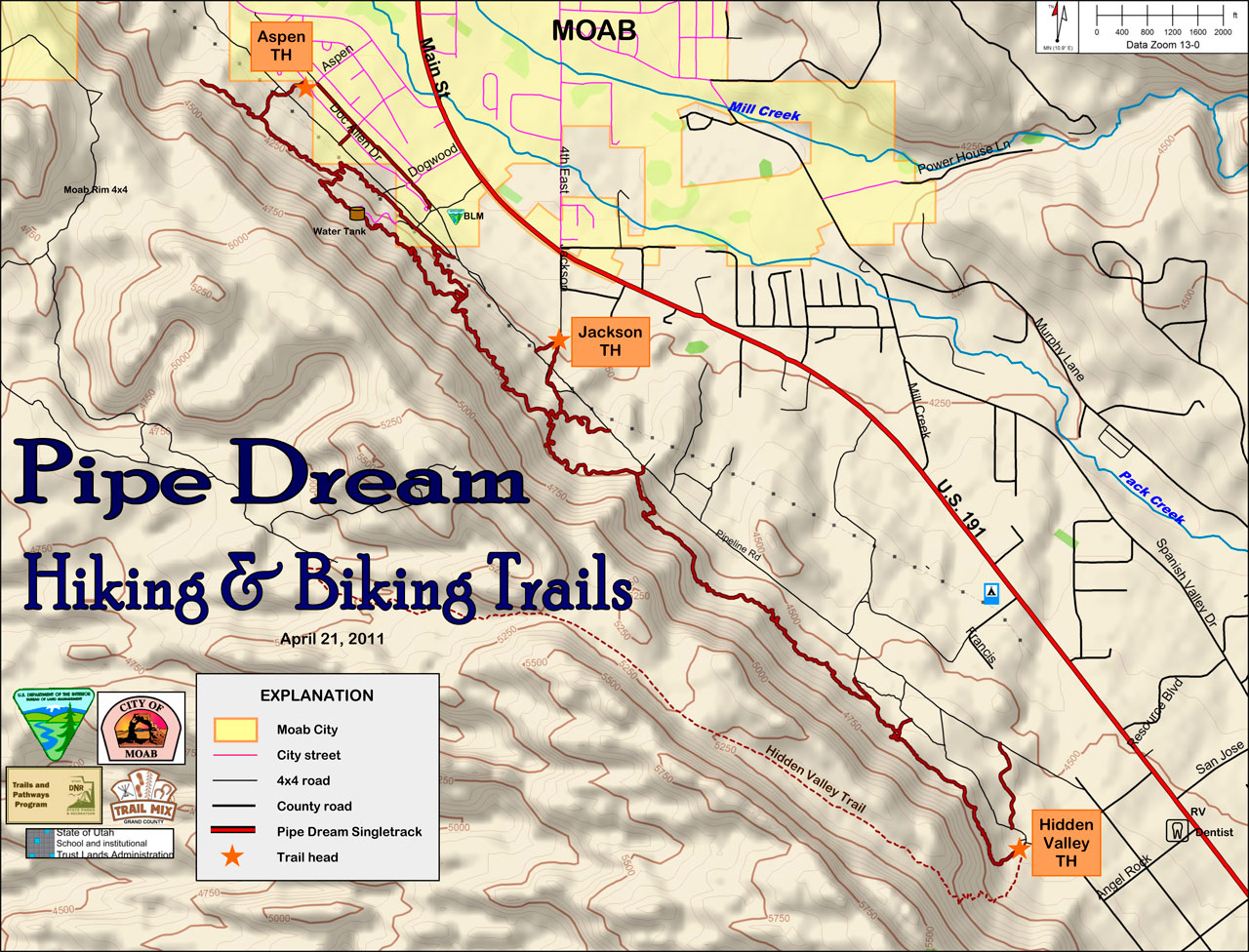
Trail Map
This system of trails gives campers recreational biking near the campground and also connects the BLM’s Horsethief Campground on Hwy 313 to the 7-Up, Mag-7, and Getaway/Great Escape trail systems, eliminating the need to drive to various trailheads to access these other trails.
Trail Map
Trailhead:
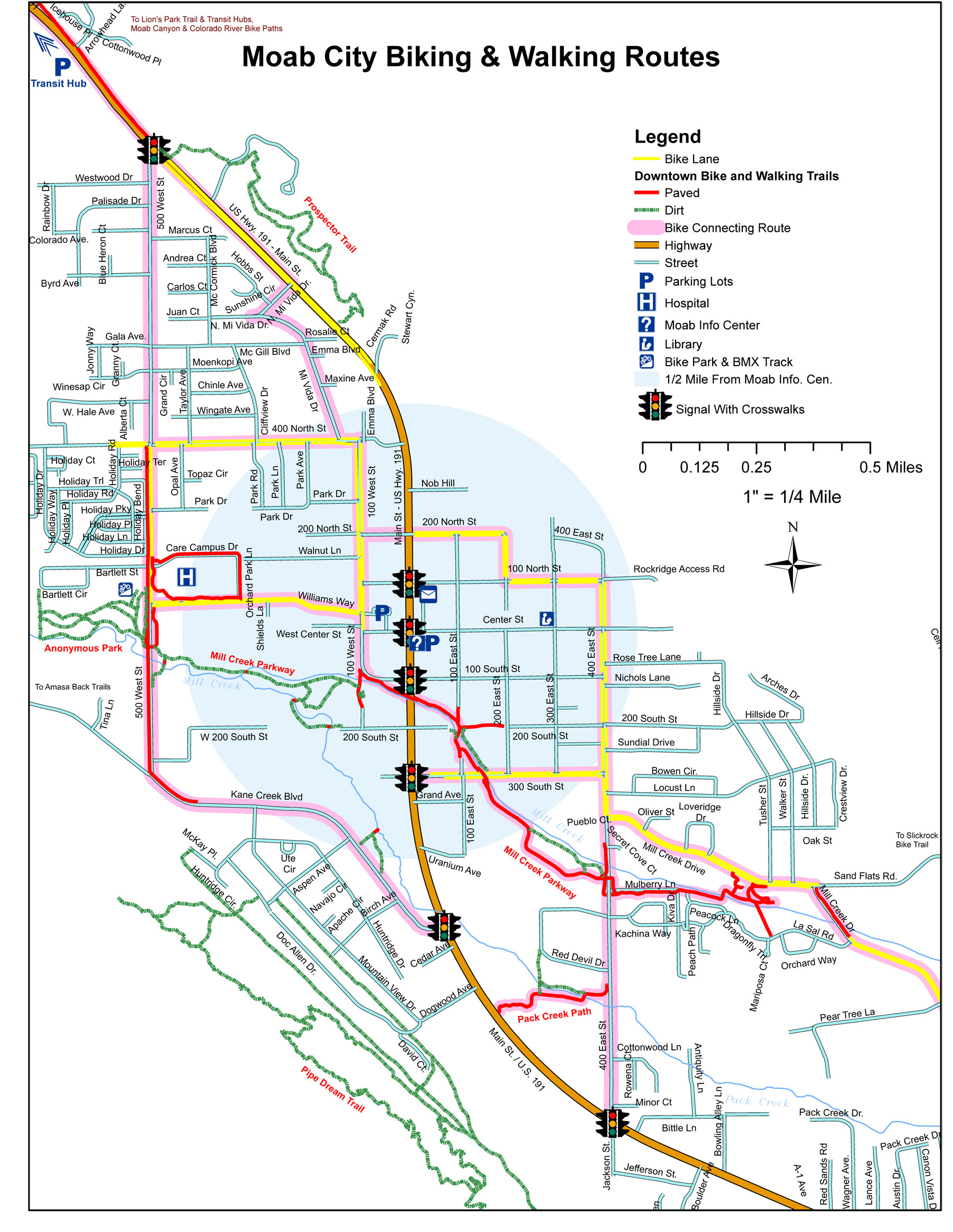
The junction of Highway 191and Kane Creek Boulevard in Moab.

Trail Map
The trailhead for the Klonzo Trails is on the Willow Springs Road approximately 12 miles north of Moab. This trail system currently has 7 trails mostly for intermediate skill level. The trails are within a Mountain Biking Focus Area designated in the BLM’s 2008 Resource Management Plan.

Trail Map
Trailhead: Take U.S. 191 North about 8 miles to the Bar-M Chuckwagon, turn right to enter the Bar-M private parking lot. Park at the South end.
Trail Map
This trail system combines 6 trails to make an epic 25-mile downhill run from the La Sal Mountains to the Colorado River. Shuttles can be arranged at any of the bike shops in town. Please note that a day use fee applies when passing through the Sand Flats Recreation Area booth by shuttle or private vehicle to ride the Whole Enchilada, Porcupine Rim and LPS trails.

Trail Map
For a more optimal web experience, please view our site on Microsoft's recommended browser, Edge. You can download it here.