- Attractions
- Activities
- Lodging + Campgrounds
- Area Info
- Services
- Transportation

Moab Area Motorcycle Trail Riding
The Moab area offers tremendous diversity for motorcycle trail riding. From graded roads to singletrack trails, you can choose a new adventure for each day of your visit… and your next visit. With that sense of freedom comes a responsibility to respect yourself, others, and the land itself. So please remember to ride within your ability, stay precisely on the designated roads and trails, and yield to people or animals. This will help to keep Moab accessible and enjoyable for generations.
Motorcycling takes a lot of rider training, vehicle maintenance, and trip planning. In Moab, a handful of guiding and rental services can assist you to make the most of your visit. If choosing to go out with your own group, be prepared. Most trails are very remote, and cellular coverage is spotty. Even in spring and fall, temperatures can reach above 100F and below 32F. Low humidity calls for bringing extra water, such as 4 quarts/liters per person. Storms cause drainages that are normally dry to become impassable, and cause clay-based dirt that is normally dusty to become extremely muddy.
Lockhart Basin, a remote 4WD trail, offers views up to Canyon Rims Recreation Area. Photo courtesy of Dave Walker
Kokopelli Trail, which is very popular for bicycling, uses many 4WD trails to reach Colorado. Photo courtesy of RwR
Along with the proper gear, groups should bring travel maps and possibly guide books. Although most of the graded roads and featured trails have directional signs, conditions are subject to change. In the event of an emergency, maps can show your options to evacuate. The government-agency maps and most commercial maps indicate which types of travel are permitted for each route. Be aware that motorcycles are not permitted on many singletrack trails, especially those closer to town.
On public lands, motorized and even bicycle travel is limited to designated routes. The Bureau of Land Management (BLM) provides up-to-date designated route maps. Likewise, the U.S. Forest Service (USFS) provides up-to-date motor vehicle use maps. Commercial maps include Moab Classic and Moab East/West by Latitude 40, which are available at the Moab Information Center (Main & Center Streets in Moab). Guide books include ATV Trails Guide and Backroads & 4-Wheel Drive Trails. These books are available at the Moab Information Center, and can also be purchased in advance online from Canyonlands Natural History Association.
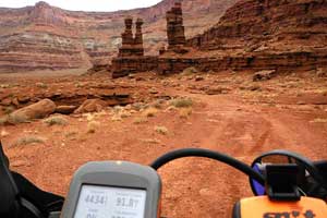
4WD trails are the perfect way for most motorcyclists to explore the canyon country. These primitive roads offer spectacular scenery, with difficulty that ranges from moderate to extreme. Their width provides room to pass, and provides an alternate line for riders to choose. Most of the routes used during Jeep Safari are marked, and extend from Moab in every direction. Originally blazed for uranium mining, these iconic trails made Moab a top 4WD destination, worldwide. For details, see our page on 4-Wheeling.
Riders seeking a longer-distance, or less-rugged, experience can utilize the network of graded, dirt roads. They are generally maintained, but of course wash outs and other hazards can occur. If your motorcycle is street-legal, you can follow graded roads all the way to towns like Green River, Monticello, and even Fruita, CO. Kokopelli’s Trail is dual-sport friendly, except for the rocky hill above Onion Creek and the non-motorized section below Cisco. Even ‘in the middle of nowhere,’ you could encounter oncoming traffic, so be careful around blind corners.
Note that, to ride the roads in national parks, your motorcycle must be street-legal and a permit is required. (Click here for permit information.) While Canyonlands and Arches are known for routes like White Rim, Elephant Hill, and Eye Of The Whale, the national parks have a mission of preservation. All kinds of use in these parks are regulated, so please be on your best behavior. For more information, visit Canyonlands or Arches.
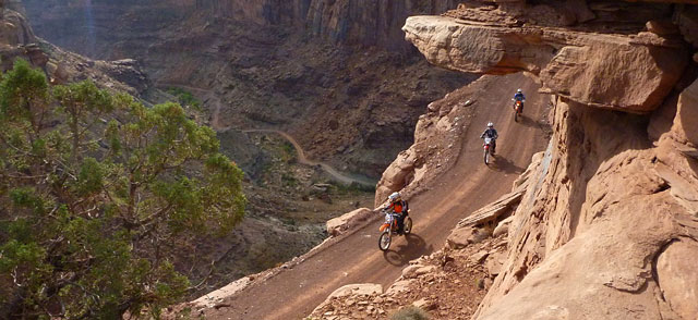
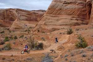
At the most primitive end of the spectrum, motorized singletrack is available for riders seeking the confines of a narrow trail. These routes typically require a high degree of balance and coordination. Also they lend themselves to lighter-weight motorcycles with a smoother power band and low gearing. Unless you particularly value singletrack, then stick to the 4WD trails for a greater sense of freedom.
For example, motorized singletracks are shared with non-motorized users, and motorcyclists should yield to them. However pulling off the singletrack could easily damage plants and biological soil crust (the black and craggy dirt that’s actually alive). So you’ll need to pass by either leaning over the trail’s edge, or finding a barren surface such as slickrock to pull over. In the desert, singletrack is a scarce commodity, so please help to keep the “single” in singletrack.
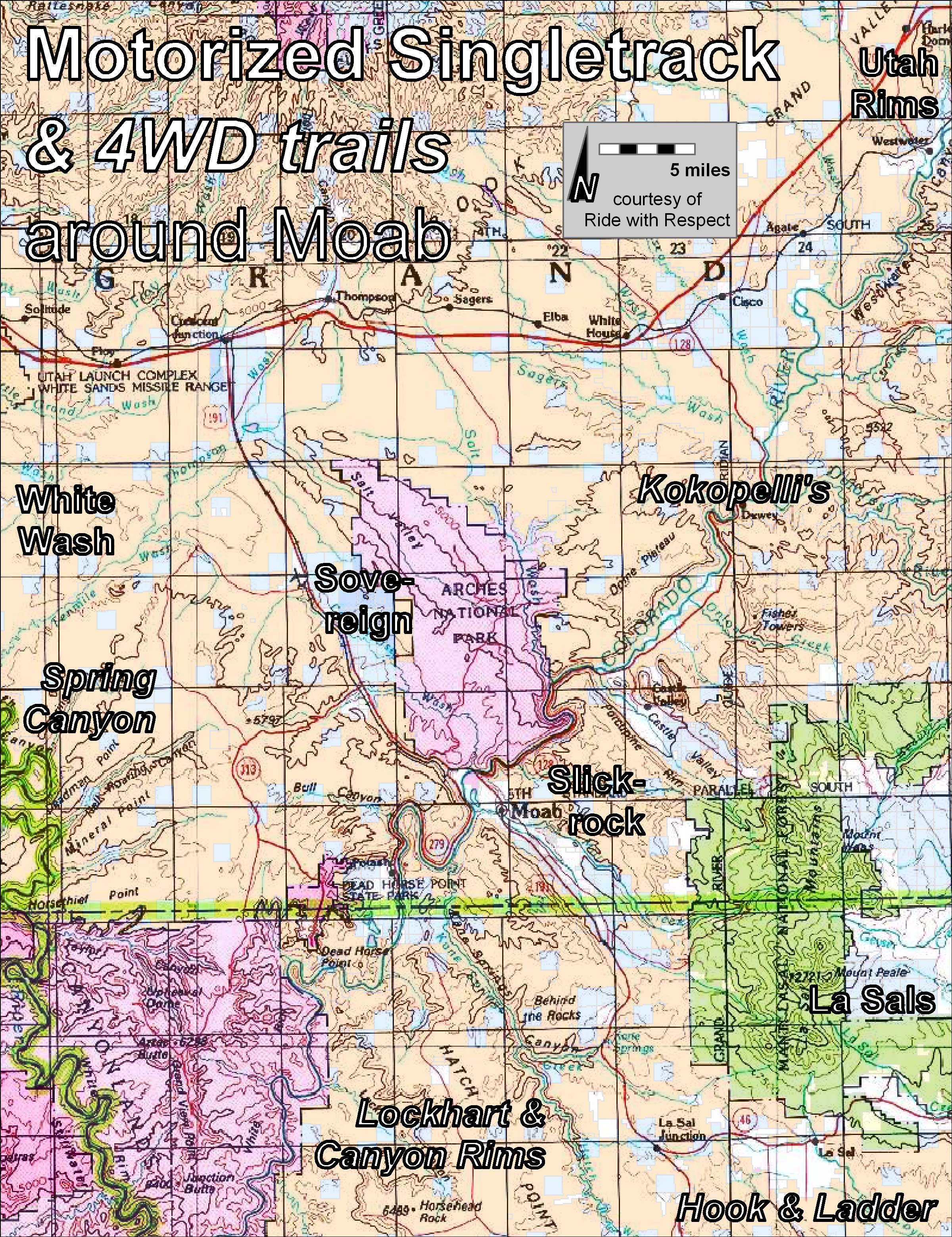
If narrow trails sound like your idea of fun, there are a half-dozen small networks of motorized singletrack to choose from. Each of them requires a map, but here’s an overview:
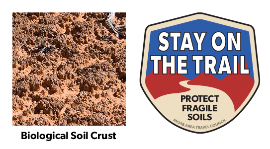
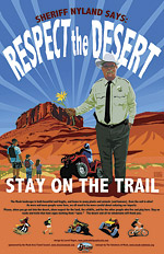
Help to keep all of our trails open. Protect this fragile, but crucial, soil by remaining on designated roads, routes and trails at all times.
Biological soil crust, also known as cryptobiotic soil, is the foundation of desert plant life. This black, knobby crust is made up of many different living organisms and plays a vital role in maintaining the desert ecosystem. However, this sensitive soil is extremely fragile and can take decades to grow. Even a footstep can damage the crust for decades, having lasting impacts on the desert environment. Please stay on the trials. Help to protect this fragile life by remaining on designated roads, routes, and trails at all times. Where hiking trails are not established, hike in sandy washes or on bare rock.
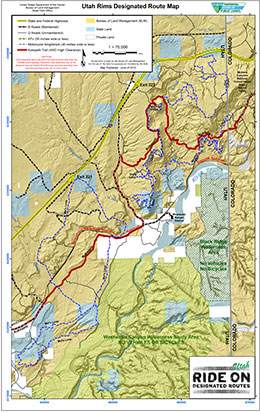
Utah Rims Designated Route Map
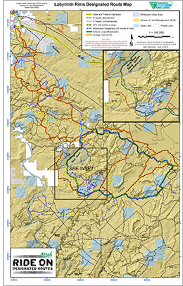
Labyrinth Rims Designated Route Map including White Wash Sand Dunes
For detailed maps of Moab’s entire Motorized Travel Routes click here.

Utah State Parks & Recreation enforces several important rules regarding vehicle registration, equipment, youth certification, and safety gear. For an overview see our ATV page. For the latest up-to-date regulations it is critical to visit ohv.utah.gov.
Need somewhere to to park your vehicle or trailer overnight? Although the city of Moab does not have any public long-term parking areas, these companies provide safe, secure storage.
Moab’s roads and trails are famous because they offer a combination of challenge and scenery that cannot be found elsewhere. Please remember that riding on public lands is a privilege, not a right. Protect this privilege by staying on designated roads and trails. Cross-country travel damages plant and soil resources, and leaves ugly long-lasting scars. Enjoy your recreational activity in the Moab area while staying on roads and trails.
In conclusion, a handful of motorized-singletrack areas complement the many 4WD trails that put Moab on the map, so to speak. Plan ahead, or utilize one of the town’s many outfitters. As the budgets of land managers have dwindled, it’s now key for motorcyclists to become trail stewards. You can even pitch in through a club like Ride with Respect, or volunteer directly through a land manager like BLM.
Above all, practice an outdoor ethic. Have a blast, but keep an eye out for your safety, for other visitors, and for the surrounding landscape. This combination of fun, challenge, camaraderie, and sheer beauty draws many people back to Moab time and time again.
*NOTE* Utah State Parks & Recreation enforces several important rules regarding vehicle registration, equipment, youth certification, and safety gear. For an overview see our ATV page. For the latest up-to-date regulations, it is critical to visit ohv.utah.gov.
For a more optimal web experience, please view our site on Microsoft's recommended browser, Edge. You can download it here.