- Attractions
- Activities
- Lodging + Campgrounds
- Area Info
- Services
- Transportation

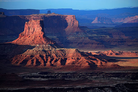
Canyonlands National Park
The largest national park in Utah, with diversity that staggers the imagination.
Phone: General Info
(435) 719-2313Backcountry Information
(435) 259-4351Mailing Address
Canyonlands National ParkDay-Use Permits
You must have a day-use permit for four-wheel-drive, motorcycle, and bicycle travel on:
Overnight Permits
River Permits
Horseback Riding, and Pack- and Stock-Use Permits
Phone: General Info
(435) 719-2313Backcountry Information
(435) 259-4351Mailing Address
Canyonlands National ParkNearby Campgrounds
In addition to the campground located within the park, there is a great selection of additional campgrounds in the surrounding area. Moab has many commercial campgrounds with RV hookups in addition to a huge assortment of BLM public campgrounds in extremely scenic locations. Click here for a complete list of all the camping options available in the Moab area.
Where to Stay
No lodging is available within the park. The closest lodging is located within the town of Moab, just 5 miles south of the entrance to the park.
Moab has hotels & motels, bed & breakfasts, resorts and a large variety of guest houses and condos. Several property management companies can even take the hassle out of finding the right accommodations. Click here for a complete list of all the lodging options available in the Moab area.
Day-Use Permits
You must have a day-use permit for four-wheel-drive, motorcycle, and bicycle travel on:
Overnight Permits
River Permits
Horseback Riding, and Pack- and Stock-Use Permits
Please note that food is not available within the park. The closest restaurants are either in the town of Moab, at Dead Horse Point State Park, or at the dinosaur museum at the intersection of Highways 191 and 313 (entrance fee is not required to access the restaurant).
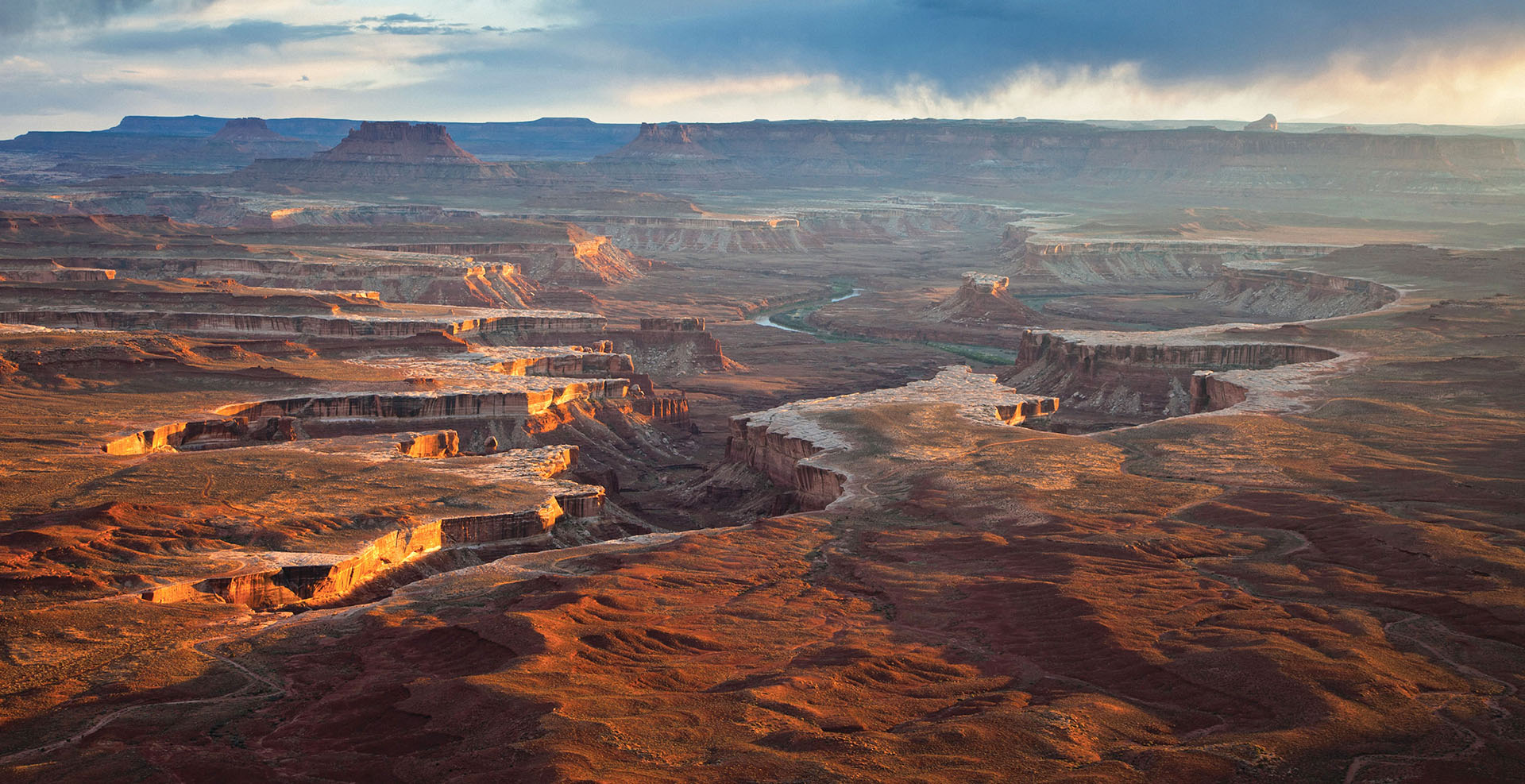
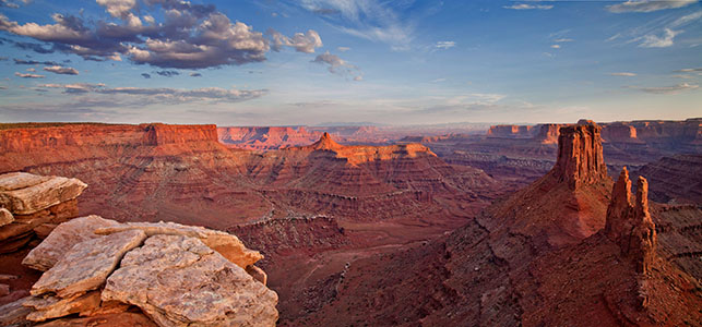
The Green River meanders beneath the Island in the Sky, as seen from the Green River Overlook. A paved walkway leads right up to the overlook.
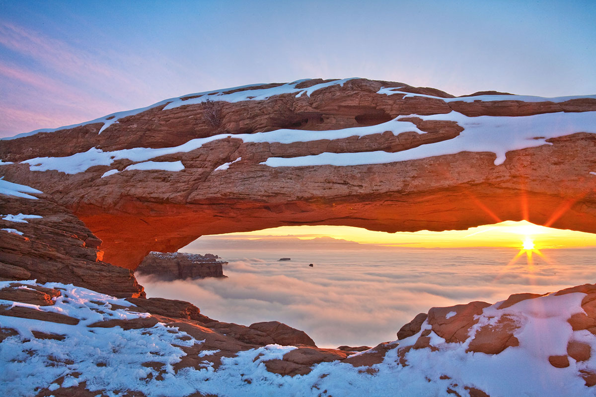
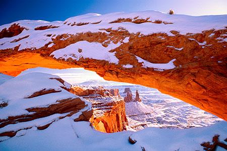
A great hike for families with small children, the .5 mi (.8 km) round trip hike to Mesa Arch rewards visitors with a naturally framed view of canyon country.
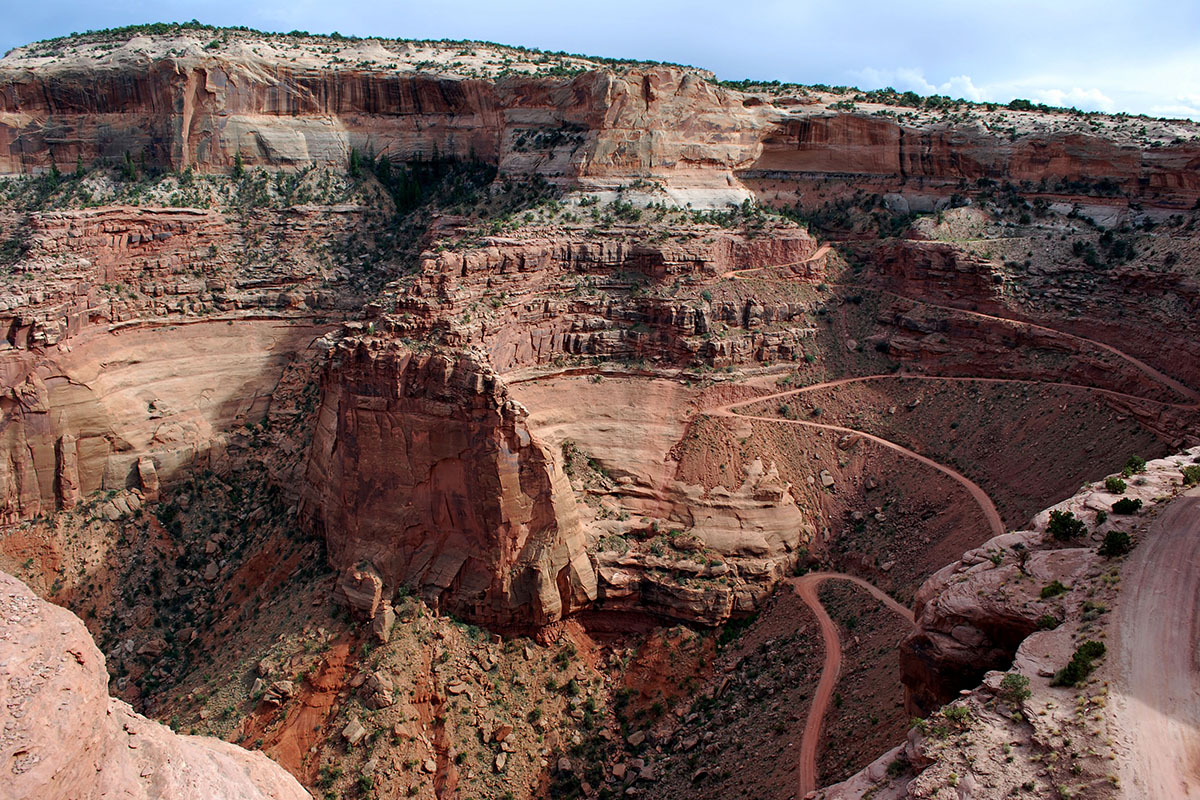
The Shafer Trail descends from the Island in the Sky to the White Rim. A high clearance vehicle is strongly recommended. For current conditions check at the visitor center or call 435-259-4351.
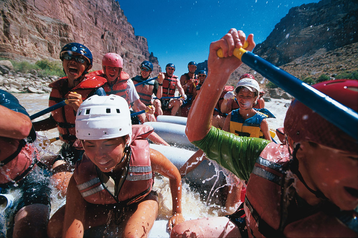
Located in Canyonlands National Park, Cataract Canyon contains fourteen miles of rapids ranging in difficulty up to Class V.
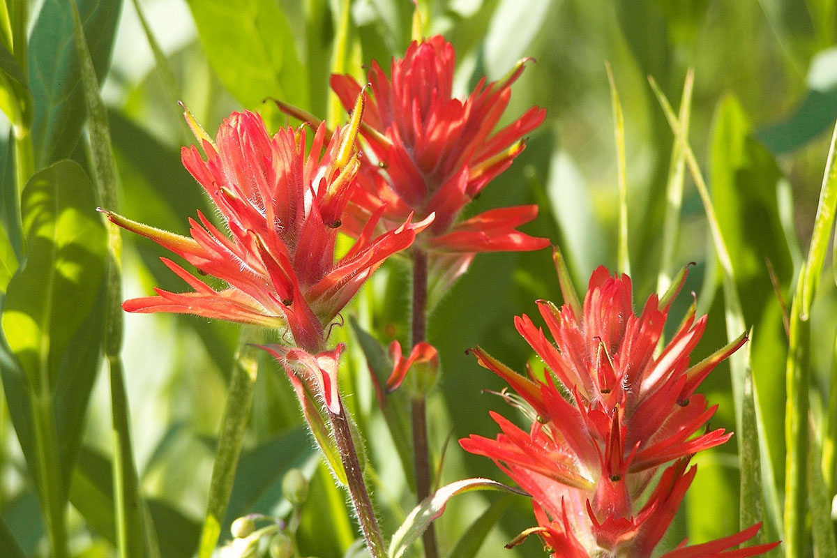
Indian Paintbrush are just one of the many wildflowers that populate the Island in the Sky in the Spring (April-June).
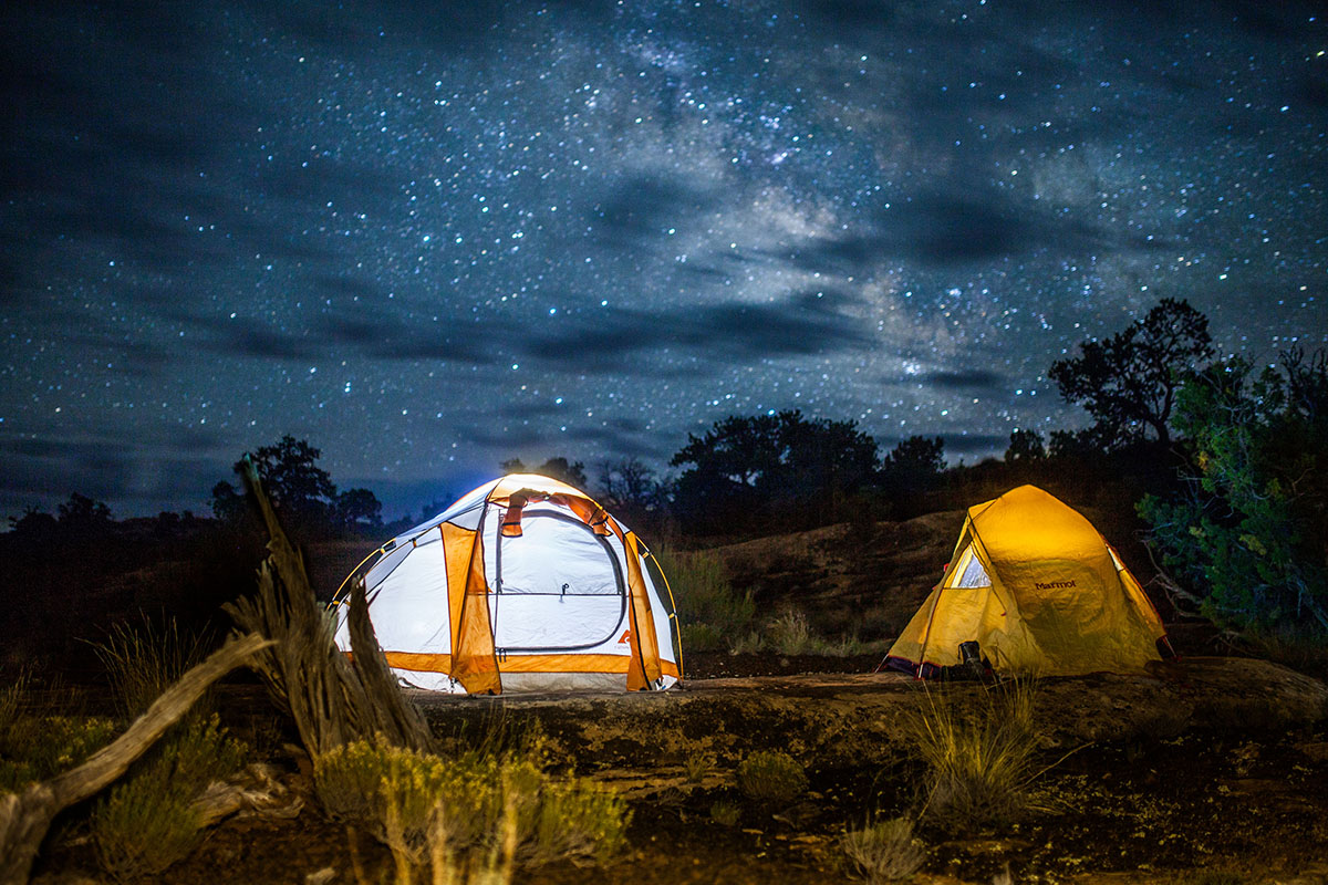
Canyonlands National Park, which contains some of the darkest night skies in North America, is a popular destination for stargazers. Click here for the latest sunrise/sunset and moon phase information for Moab.
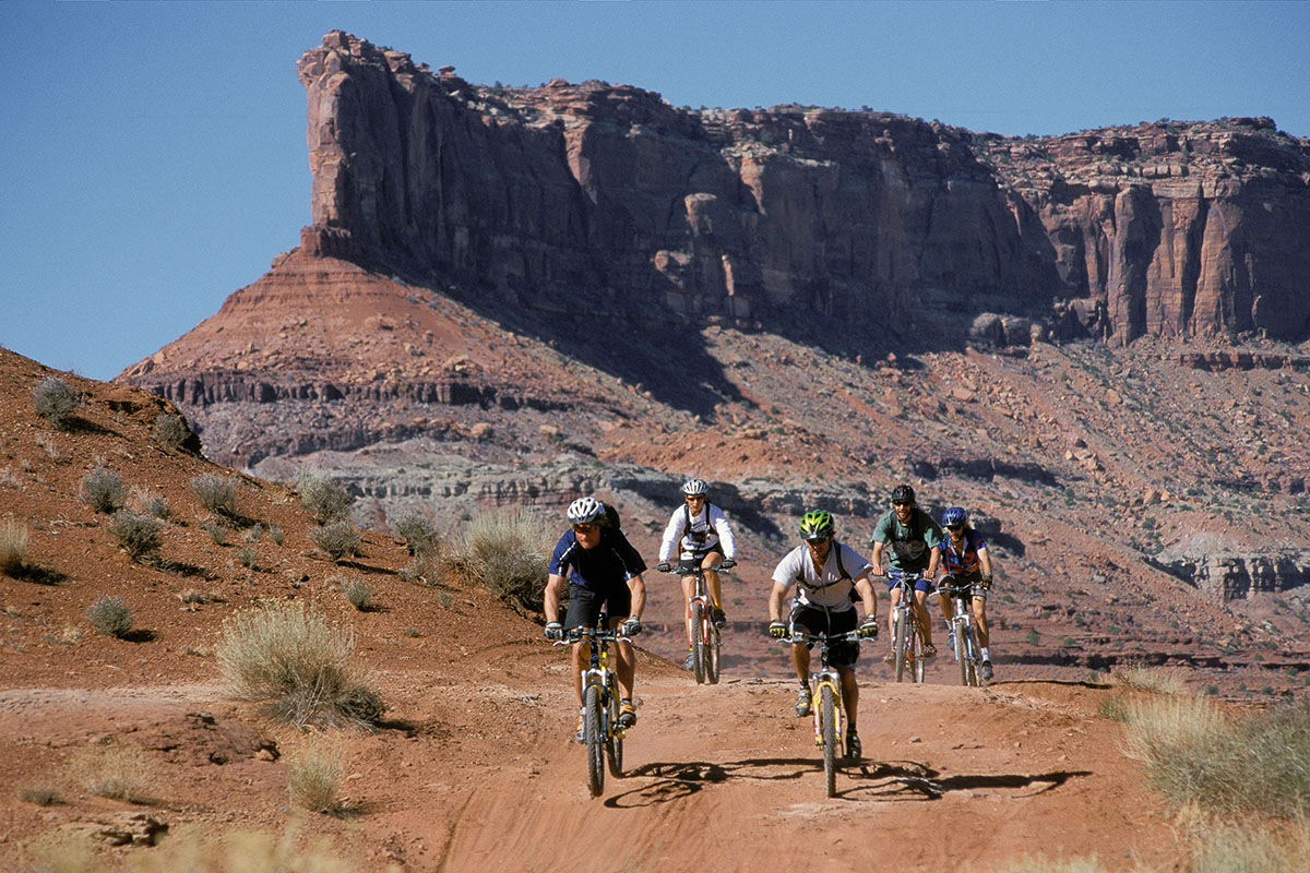
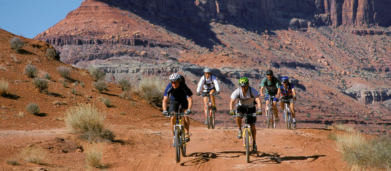
Canyonlands is famous for its mountain biking terrain, particularly for the 100-mile White Rim Road at the Island in the Sky. The Maze also offers some multi-day trip possibilities, though the logistics and roads are more difficult (for the support vehicles, not the bikes).
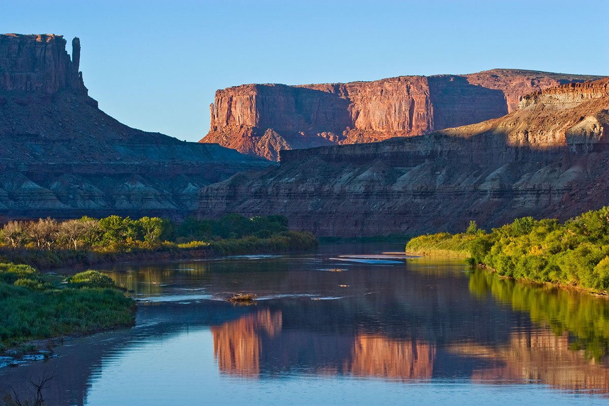
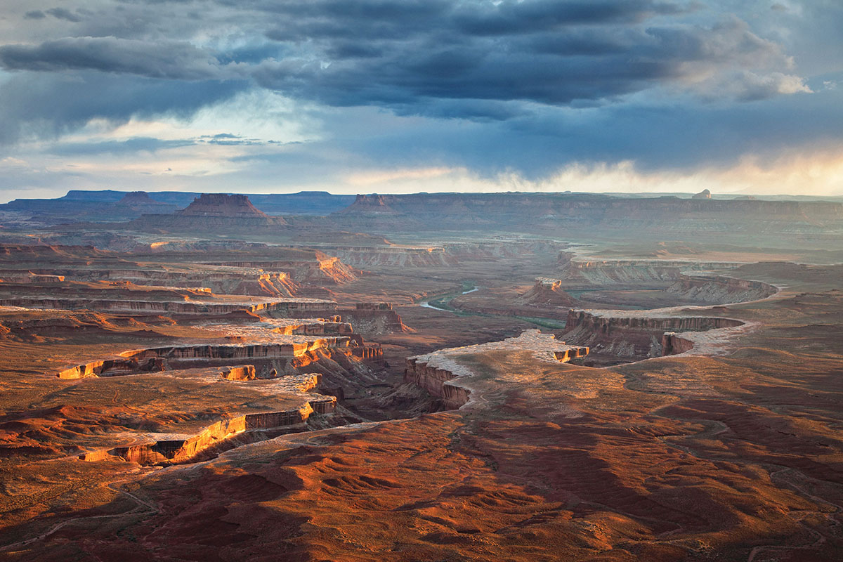
The Colorado and Green rivers wind through the heart of Canyonlands, cutting through layered sandstone to form two deep canyons. Both rivers are calm upstream of the Confluence, ideal for canoes, kayaks and other shallow water craft. Below the Confluence, the combined flow of both rivers spills down Cataract Canyon with remarkable speed and power, creating a world-class stretch of white water.
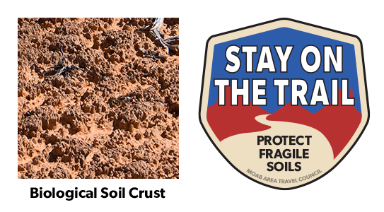
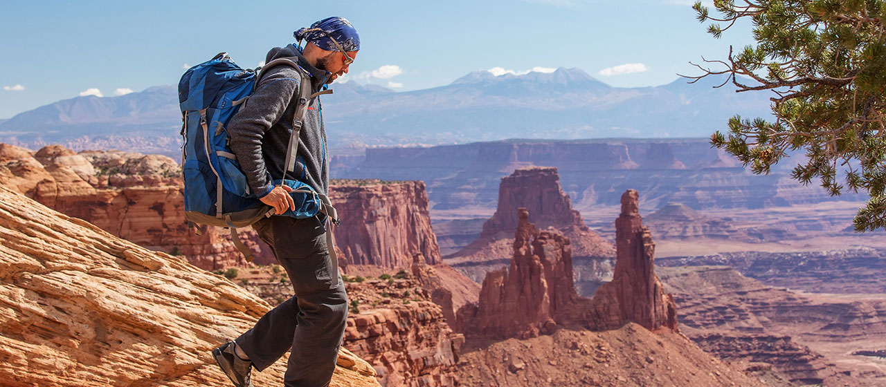
Your help is crucial in preserving our trails and protecting the fragile soil that sustains the desert ecosystem. The biological soil crust, also known as cryptobiotic soil, serves as the foundation for desert plant life. This unique black, knobby crust is composed of diverse living organisms and plays a vital role in maintaining the delicate balance of the desert environment.
However, this soil crust is exceptionally delicate and can take several decades to regenerate. Even a single footstep can cause irreparable damage that can persist for years, impacting the entire ecosystem. We urge you to stay on designated roads, routes, and trails to ensure the preservation of this fragile life. In areas where hiking trails are not established, it is advisable to hike on sandy washes or bare rock surfaces to minimize the impact on the soil.
By remaining vigilant and adhering to these guidelines, you contribute to the long-term sustainability of the desert ecosystem and help safeguard its natural beauty for generations to come. Let’s work together to keep all of our trails open and protect the invaluable biological soil crust.
With hundreds of miles of four-wheel-drive roads, Canyonlands offers ideal terrain for multi-night mountain bike trips. Most groups travel with vehicle support to haul water and gear since there are few reliable water sources along these roads. For the truly adventurous, self-supported trips with panniers and trailers are also possible. Bikes must remain on designated roads: there are no single-track trails in the park.
Things to Know
Where Can I Ride My Bike?
You can ride a bicycle on any public roadway in the park. Some roads are better for cycling than others. Check at visitor centers for recommendations and road conditions.
Paved Roads
You can ride on paved roads at the Island in the Sky. You must must ride single file. There are no road shoulders or bike lanes; please be aware of passing vehicles.
Backcountry Roads
Canyonlands is famous for its mountain biking terrain, particularly for the 100-mile White Rim Road at Island in the Sky. The 100-mile White Rim Road loops around and below the Island in the Sky mesa top and provides expansive views of the surrounding area. Bicycle trips usually take three to four days. Overnight and day-use permits are required.
Do I Need a Permit?
During the spring and fall, demand for permits frequently exceeds the number available. If you plan to visit Canyonlands during peak season, especially to bike and camp along the White Rim Road, we recommend making reservations well in advance. You can reserve overnight permits up to four months in advance of the start of your trip. Day-use permits are available up to 24 hours in advance of your trip.
Mountain bike groups must travel single-file, remain on established roads, and camp in designated sites. There is no single-track riding in the park. We recommend a support vehicle for all multi-day bike trips: there are no water sources along most of the roads. Guided trips are available for many destinations within Canyonlands.
On August 30, 2019 the National Park Service announced a new electric bicycle (e-bike) policy for national parks, expanding recreational opportunities and accessibility. The policy supports Secretary’s Order 3376, signed by U.S. Secretary of the Interior David Bernhardt on August 29, 2019, that directs Department of the Interior (DOI) bureaus to create a clear and consistent e-bike policy on all federal lands managed by the Department.
Beginning October 1, 2019, visitors to Southeast Utah Group parks (Arches and Canyonlands national parks and Hovenweep and Natural Bridges national monuments) will be allowed to use e-bikes where traditional bicycles are allowed. Bicycles and e-bikes are allowed on paved and unpaved roads that are open to the public. Bicycles and e-bikes are not allowed on any trails in the parks.
There are no charging stations in the parks. Generators are not allowed in the backcountry. This change in e-bike policy applies to private and commercial use in the parks.
The National Park Service announcement and the agency’s new e-bike policy are available online at www.nps.gov/orgs/1207/ebikepolicy.htm.
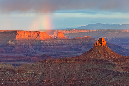
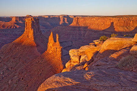
Canyonlands is a paradise for photographers. Under conditions of constantly changing light, the varicolored landscape provides limitless photographic opportunities. Often, the difference between an average photograph and an exceptional photograph is good lighting. Low sun angles at sunrise and sunset can add brilliant color to the rock. Scattered clouds can also add depth to an image and a passing storm can provide extremely dramatic lighting.
Canyonlands Natural History Association
Canyonlands Natural History Association (CNHA) is a nonprofit organization assisting the National Park Service in its educational, interpretive and scientific programs throughout southeast Utah. Known as a "cooperating association," CNHA’s goals include enhancing visitors’ understanding and appreciation of public lands by providing a selection of quality, educational materials for sale in many vistor centers. Twenty percent of these sales is returned to the National Park Service and other federal land management agencies.
CNHA operates the bookstore at Arches Visitor Center.
Friends of Arches and Canyonlands Parks
The Friends of Arches and Canyonlands Parks: Bates Wilson Legacy Fund provides direct support to Arches and Canyonlands national parks and Natural Bridges and Hovenweep national monuments in order to enhance existing projects in these spectacular areas, and to conserve the land and its cultural treasures for present and future generations to enjoy.
This mission honors the legendary work of Superintendent Bates Wilson, who came to Arches in 1949, inspiring and leading the effort that resulted in the establishment of Canyonlands National Park in 1964. The Friends Group offices are in the Rock House behind Arches Visitor Center, where Bates once lived with his family.
For a more optimal web experience, please view our site on Microsoft's recommended browser, Edge. You can download it here.