×
attractions activities lodging + campgrounds area info services transportation events submit an event moab snapshot contact search Visit Utah

Moab Mountain Biking

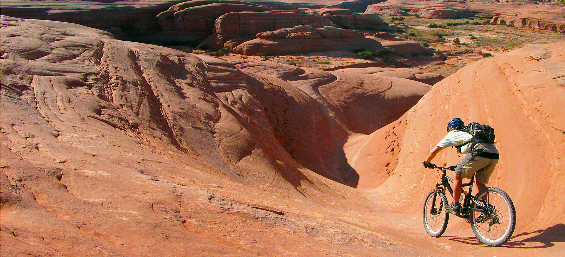
Moab is home to the greatest mountain biking on the planet!

Introduction

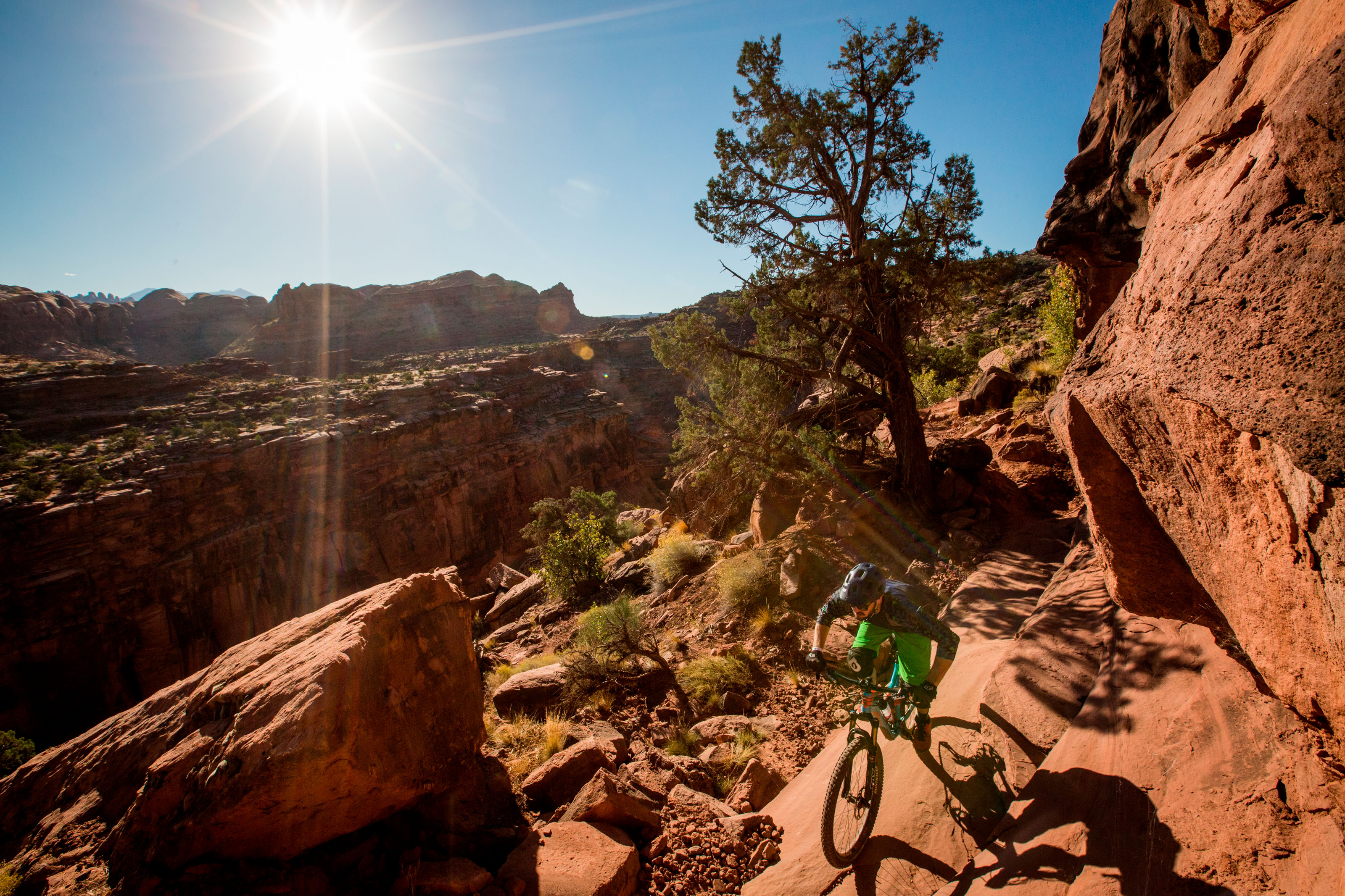
Welcome to Moab, home to some of the best mountain biking trails on the planet. Whether you’re a beginner or a seasoned biker, there’s something for everyone here. With a vast array of trails to choose from, Moab offers stunning rides through canyons and mesa tops, as well as challenging routes that will push your skills to the limit.

One of the most famous trails in Moab is the Slickrock Bike Trail. At 9.6 miles, it’s a highly technical ride that’s considered the ultimate mountain biking experience by many. But don’t worry if you’re not ready for that level of challenge yet. Moab also offers an assortment of easier trails that are no less beautiful. Take the Bar-M Loop Trail, for example, which provides a great introduction to the varied terrain and stunning scenery near Arches National Park.

Explore this page to plan your own mountain biking adventure and experience the thrill of riding through Moab’s breathtaking landscapes.

Moab’s extensive and challenging trail system is unlike any other in the world.
The National Ability Center can help people of all ability levels access Moab’s world famous mountain biking trails.

Moab Mountain Biking Trail Summary

Route Recommendations

Moab Brands Trail System Recommended Routes

Klonzo Trail System Recommended Routes

Trail Difficulty Guide

Easy

Intermediate

Difficult

Current Moab Trail Conditions

Trail Quick Links

Guided Tours/Bike Rentals

Need to rent a bike, or set up a guided bike tour? Moab has a huge variety of mountain biking guides & outfitters. Click here to check out our complete list of what is available in Moab.

Trail Difficulty Guide

Easy

Intermediate

Difficult

Amasa Back Area


  • Amasa Back (Cliffhanger Road)
  • Jackson
  • Rockstacker
  • Pothole Arch
  • Captain Ahab
  • HyMasa

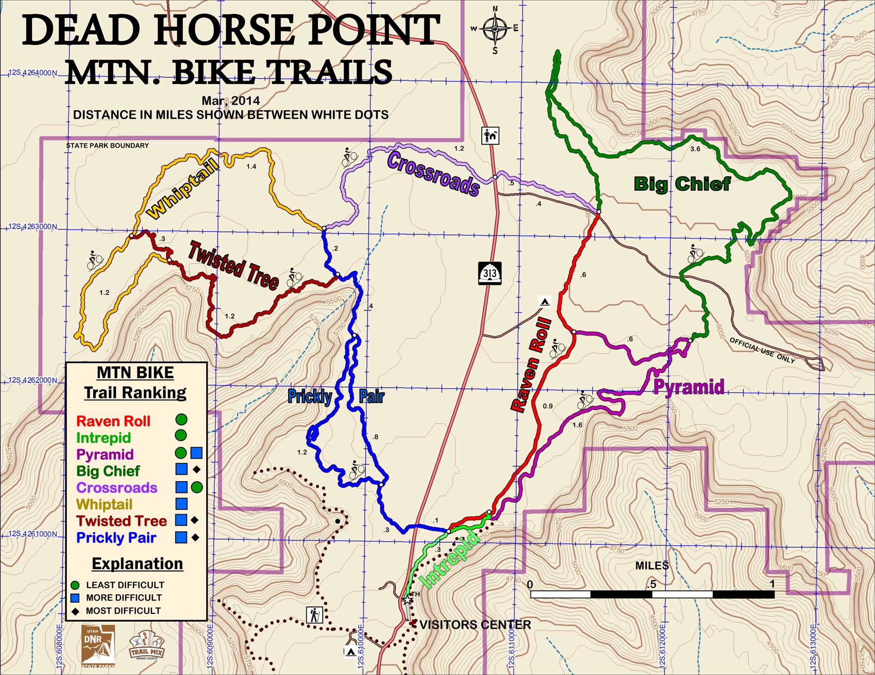
Dead Horse Point State Park


  • Intrepid
  • Great Pyramid
  • Big Chief
  • Raven Roll
  • Crossroads
  • Whiptail
  • Twisted Tree
  • Prickley Pair

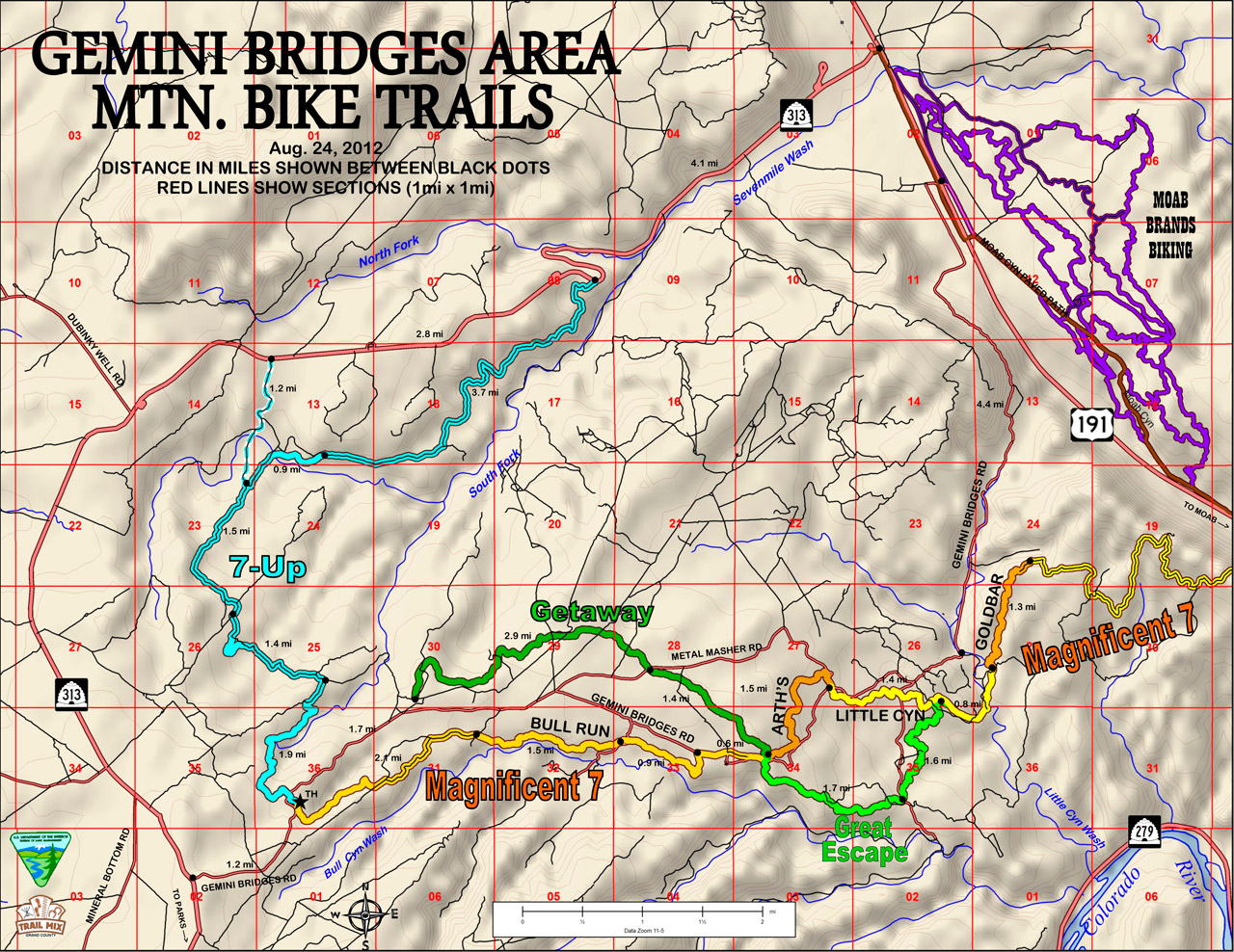
Gemini Bridges Road & Beyond

The Magnificent 7-This system of trails/roads currently has 2 options: Using the Portal Trail to end at SR-279 or Using the Poison Spider 4×4 road as the exit to SR-279.


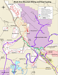
Trail Map

  • Bull Run
  • Arth’s Corner
  • Little Canyon
  • Gold Bar
  • Golden Spike 4×4
  • Poison Spider 4×4 (Spidey)
  • Portal
  • Great Escape
  • Getaway
  • 7-Up
  • Gemini Bridges Road

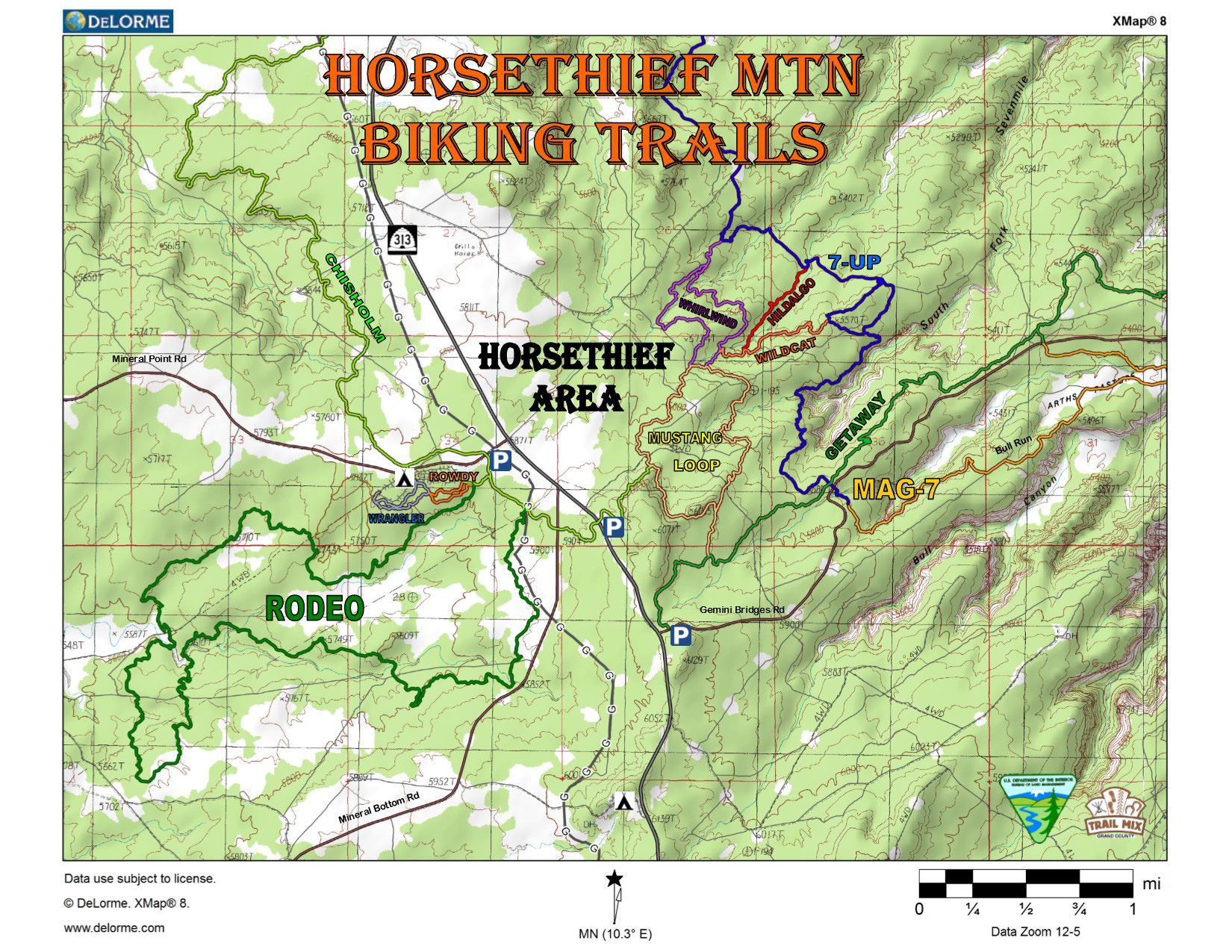
Horsethief

This system of trails gives campers recreational biking near the campground and also connects the BLM’s Horsethief Campground on Hwy 313 to the 7-Up, Mag-7, and Getaway/Great Escape trail systems, eliminating the need to drive to various trailheads to access these other trails.

Trail Map

  • Wrangler
  • Rodeo
  • Rowdy
  • Chisholm
  • Mustang Loop
  • Whirlwind Loop
  • Hidalgo
  • Wildcat

Hurrah Pass

Trail Map

  • Hurrah Pass Trail

Klondike Bluff Area

Trailhead:
The junction of Highway 191and Kane Creek Boulevard in Moab.


Trail Map

  • Klondike Bluff(4×4)
  • Baby Steps Loop
  • EKG
  • Little Salty
  • Mega Steps
  • UFO
  • Alaska
  • Nome
  • Homer
  • Dino Flow
  • Jurassic
  • Agate Loop and Centerline Trail
  • Jasper Loop and connectors to Copper Ridge Road
  • Inside Passage
  • Inside Passage
  • Miner’s Loop
  • Chilkoot Pass
  • Sidestep (north)
  • Sidestep (south)
  • Instep
  • Malachite
  • Azurite

Klonzo

The trailhead for the Klonzo Trails is on the Willow Springs Road approximately 12 miles north of Moab. This trail system currently has 7 trails mostly for intermediate skill level. The trails are within a Mountain Biking Focus Area designated in the BLM’s 2008 Resource Management Plan.

Trail Map

  • Borderline
  • Wahoo
  • Cross Canyon
  • Secret Passage
  • Snippet
  • Dunestone
  • Boondocks
  • The Edge
  • Hotdog
  • Topspin
  • Midway
  • Zoltar
  • Houdini
  • Red Hot
  • Roller Coaster
  • Carousel
  • Wizard
  • Magician
  • Gypsy
  • Gravitron
  • Vertigo
  • Zephyr (connects Klonzo & MOAB Brands mountain biking areas)

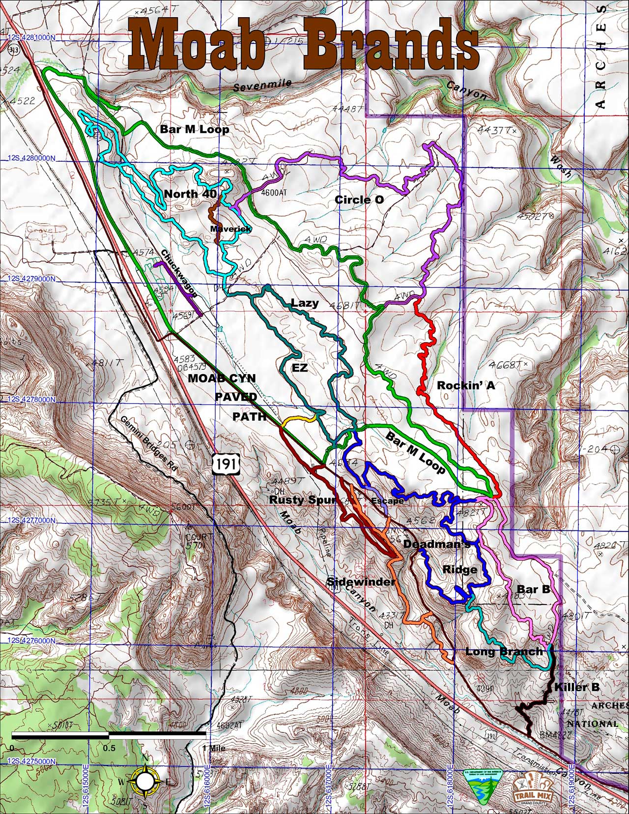
MOAB Brands Focus Area

Trailhead: Take U.S. 191 North about 8 miles to the Bar-M Chuckwagon, turn right to enter the Bar-M private parking lot. Park at the South end.

  • Bar-M Loop
  • Pipeline Spur
  • Rusty Spur
  • Maverick
  • Chuckwagon
  • Lazy
  • EZ
  • EZ Spur
  • North 40
  • Circle-O
  • Rockin’ A
  • Bar-B
  • Deadman’s Ridge
  • Escape
  • Long Branch
  • Killer-B
  • Sidewinder

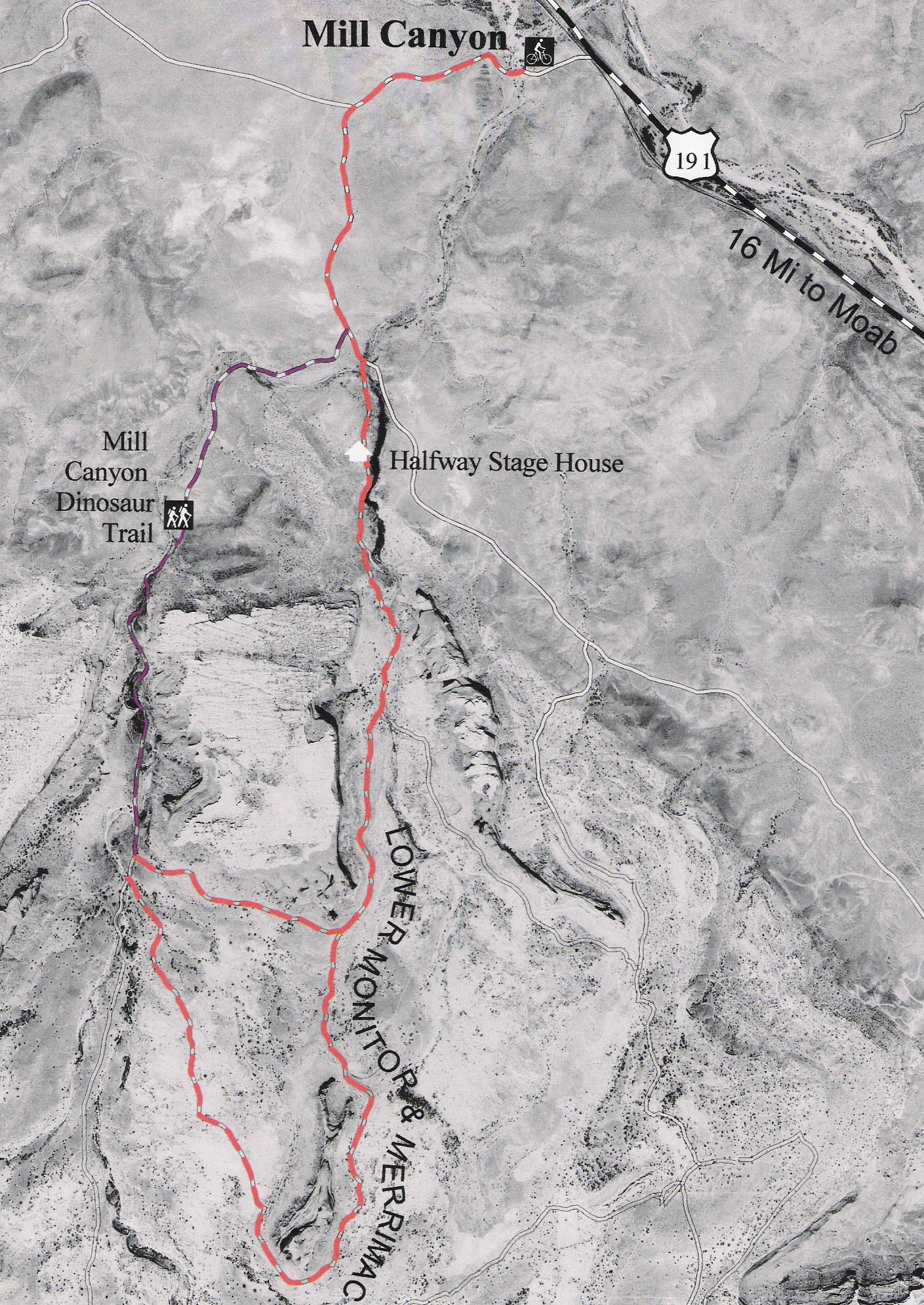
Monitor & Merrimac Trail


Trail Map

  • Lower Monitor & Merrimac Trail

Trail Map

  • Rocky Tops
  • Ramblin’
  • Big Mesa
  • Big Lonely
  • Coney Island

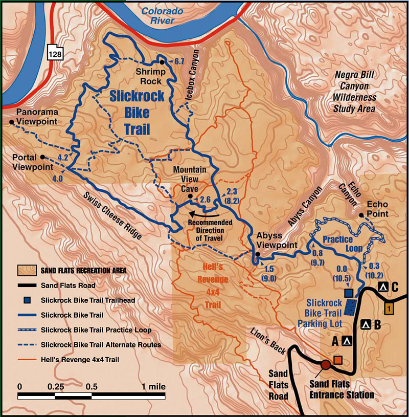
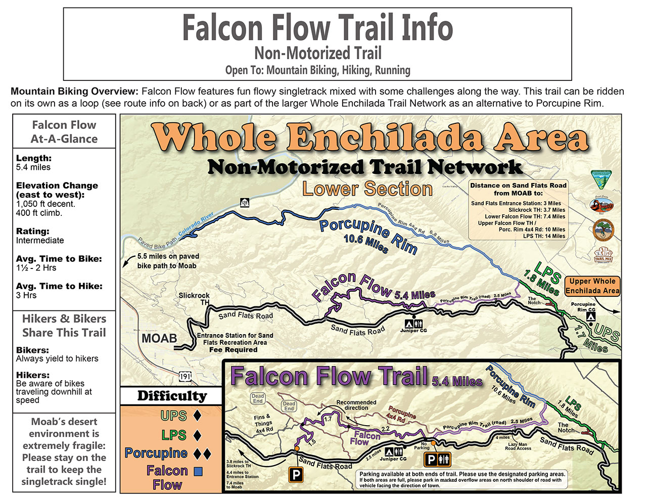
Sand Flats Recreation Area


Trail Map

  • Slickrock Bike Trail
  • Porcupine Rim
  • LPS (Lower Porcupine Singletrack)
  • Falcon Flow

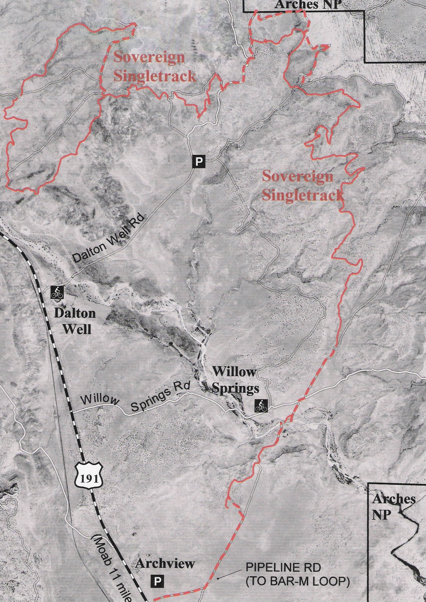
Sovereign Single Track


Trail Map

  • Sovereign Single Track

Spanish Valley & Sand Flats Recreation Area

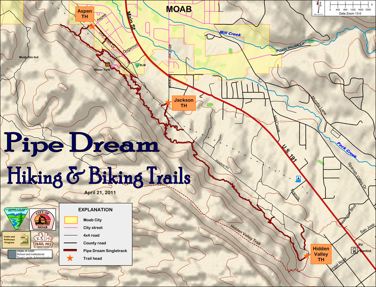
  • Pipe Dream (high line)
  • Prospector

Whole Enchilada

This trail system combines 6 trails to make an epic 25-mile downhill run from the La Sal Mountains to the Colorado River. Shuttles can be arranged at any of the bike shops in town. Please note that a day use fee applies when passing through the Sand Flats Recreation Area booth by shuttle or private vehicle to ride the Whole Enchilada, Porcupine Rim and LPS trails.


Trail Map

  • Burro Pass
  • Hazzard Country
  • Kokopelli Leg
  • UPS (Upper Porcupine Singletrack)
  • LPS (Lower Porcupine Singletrack)
  • Porcupine Rim

La Sal Loop – Moab Front Recreation Area

The La Sal Loop – Moab Front Recreation Area is located in the La Sal Mountains, south of Moab. This recreation area provides many opportunities for mountain and road biking during the summer months, when temperatures are usually 20 degrees cooler than in the desert below. The La Sal Mountain Loop Road starts south of Moab, climbs up into the mountains and traverses the western side of the mountains to come out in Castle Valley. This area includes 3 campgrounds: Warner Lake, Oowah Lake, and Mason Draw. Perhaps one of the most photographed mountain ranges in Utah, the La Sal Mountains form a spectacular backdrop to the red rock features in the desert below.

Note: Due to the high elevation and steep nature of these mountain trails, most of them are difficult and require advanced mountain biking skills.

Areas for Mountain Biking at La Sal Loop – Moab Front Recreation Area

Bike Safety

The Moab area offers challenging riding amidst world-class scenery. The characteristics of the area that make it a special place for riding also make it extremely important to follow basic safety procedures. The Moab Bike Patrol has this to say:

Wear a helmet

Most trails are very rocky. Even the best riders can get tired and make mistakes. Helmets can prevent or reduce the severity of head injuries.

Carry lots of water and high-energy food.

At least a gallon of water is recommended per person per day. There is no water on the trails and summer temperatures often climb above 100 degrees Fahrenheit. Running out of water will put your health at risk. Eating at intervals provides an opportunity to rest and the energy needed to complete the ride.

Carry trail maps and know how to use them to track your position

Maps for Slickrock and Porcupine Rim trails are located at the trailheads and entrance station. Maps for 4WD roads are available at the entrance station. Detailed topographic maps are available in Moab at bike shops, bookstores and the Moab Information Center.

Stay found, save money.

Grand County has the highest incidence of search and rescue in Utah. The high cost of these operations is normally the responsibility of the rescued party. If you decide that you have lost the trail, do not continue on in hopes of finding your own way. Retrace your route back towards the trailhead until you pick up the trail, find someone who knows the area, or return to the trailhead. If you cannot retrace your route, stay put, conserve energy and water, make yourself visible and await rescue. It’s always a good idea to let a friend or relative know beforehand where you are going and when you should return. If something goes wrong you have the comfort of knowing that they will get help.

Check your bike frequently.

Riding in Moab trails loosens headsets and puts maximum stress upon frames and components. Frequent inspections reduce the possibility of injury. Be prepared in case of emergency.

Don’t venture into remote areas with nothing but a t-shirt and shorts.

Carry a windbreaker, sunscreen, sunglasses, maps, matches or lighter, pump, patch kit, first-aid kit, a good bike tool kit and extra food, water and clothing.

Ride with someone else and stay together in case of problems.

Discuss your situation calmly and make a plan to improve it.


Trail information courtesy of Geoff Freethey and Trail Mix.

Note: The information on this page is provided as a courtesy to area visitors. No warranty, expressed or implied, is made as to the safety or ongoing validity of this information. Grand County, Utah or its agents are not responsible for any liability arising from the use of the information presented here.

For a more optimal web experience, please view our site on Microsoft's recommended browser, Edge. You can download it here.